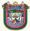
Ayabaca Province (Provincia de Ayabaca)
 |
 |
Two bus companies cover the route Piura-Sullana-Ayavaca. The trip takes from 5 to 6 hours approximately. The province has a large border with Ecuador, and the oriental branch of the Pan-American Highway crosses the Suyo district, at the north of the province, connecting Piura, Sullana and Las Lomas with the Ecuadorian cities of Macará and Loja.
The name Ayabaca, also written as Ayavaca, derives from two Quechua roots: aya, related to death, but also to immortality; and huaca connected to sanctuaries and sacred places. Some local monographs have limited its meaning to that of "grave and ancient tomb of the dead" ("tumba de muertos"). They believe this meaning suggests the name was derived from a site with ancient bones and primitive weapons found near the zone where the Spaniards gathered the native population in 1571, when they founded the first "Pueblo de Indios de Nuestra Señora del Pilar de Ayavaca" or missioni Ayavaca Vieja. Such bones and weapons may be the "remains of hordes fallen in combat against the expansionist advance of the Incas".
Aya does not mean only a deceased or ancestor in the physical sense of the corpse or skeleton, but also in the symbolic and spiritual sense of the soul, consciousness and energy that departs the body, temporarily at night and definitely at the end of the life, but continues circulating in all vital processes, as the cycles of water, light and seasons, that move along with the Earth. With that association, aya is also related to the pale red or yellowish colors of twilight and of dawn, as well as to the paleness of newborns and dying persons. Huaca is the name of sacred places or objects. In this sense, the old sanctuary of Ayavaca or Ayahuaca, situated in the western extreme of the mountain range of the Andes, an area where all regional rivers have their sources, is properly the Sanctuary of Death, but also of Immortality, of life’s changes and creative transformation.
Map - Ayabaca Province (Provincia de Ayabaca)
Map
Country - Peru
 |
 |
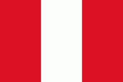
| Flag of Peru | |
Peruvian territory was home to several cultures during the ancient and medieval periods, and has one of the longest histories of civilization of any country, tracing its heritage back to the 10th millennium BCE. Notable pre-colonial cultures and civilizations include the Caral-Supe civilization (the earliest civilization in the Americas and considered one of the cradles of civilization), the Nazca culture, the Wari and Tiwanaku empires, the Kingdom of Cusco, and the Inca Empire, the largest known state in the pre-Columbian Americas.
Currency / Language
| ISO | Currency | Symbol | Significant figures |
|---|---|---|---|
| PEN | Peruvian sol | S/ | 2 |
| ISO | Language |
|---|---|
| AY | Aymara language |
| QU | Quechua language |
| ES | Spanish language |


